Nullam dignissim, ante scelerisque the is euismod fermentum odio sem semper the is erat, a feugiat leo urna eget eros. Duis Aenean a imperdiet risus.

shape-img
Invent Better, Differently.

Powering Malaysia's
Digital Infrastructure
Together

We deliver geospatial mapping, infrastructure expertise, and digital solutions for Malaysian organisations to operate smarter.

img
shape-img
shape-img
shape-img

What We Can Do For You

We Bring the Technology, the Team, and the Know-How.

Whatever stage you are at, we are here to help, whether you need a ready-made platform, skilled people on the ground, or guidance on where to start.

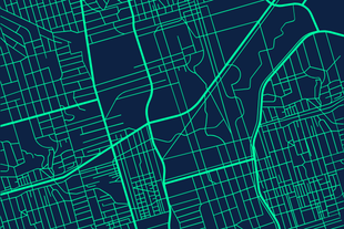
  • Platforms you can brand as your own, custom-built systems, and mapping tools tailored to your workflows
  • Experienced GIS specialists, surveyors, and field technicians available for both office and on-site work
  • Advice, setup support, and training so your team feels confident using every system we deliver
Your needs Platforms White-label · custom-built · mapping data People GIS specialists · surveyors · field technicians Guidance Advice · setup support · training Support & infrastructure Ongoing ops · hosting · integrations

Our Experience in Numbers

10,000+ KM

Geospatial Coverage Mapped

Over 10,000 kilometres of roads, utility corridors, and infrastructure networks surveyed, mapped, and managed across Malaysia.

RM 10M+

Revenue Generated for Clients

Our platforms and systems have directly supported clients in unlocking operational savings, streamlining compliance, and driving measurable revenue growth.

100+ Experts

Qualified In-House Team

A multidisciplinary team of GIS specialists, licensed surveyors, IoT engineers, software developers, and certified technical professionals ready to deliver.

15+ Years

Combined GIS & Field Experience

Serving state governments across Pahang, Perak, Terengganu, and Negeri Sembilan.

Technology Provider for

Working With Us

Yes. We serve government agencies and state-linked organisations with strict access controls, secure handling protocols, and data compartmentalisation. Access is restricted by authorisation level, and your data is never resold, reused, or shared without explicit written consent.

All surveys are conducted using calibrated, industry-standard equipment alongside licensed surveyors. Deliverables conform to Malaysian surveying standards and undergo full quality assurance validation before handover.

You do. Full data ownership transfers to the client upon project completion. Ownership rights and confidentiality terms are defined clearly in every project agreement from the outset.

Unlike firms that deliver raw data and step back, Asia Debut integrates field surveying, digital mapping, system development, and deployment into one end-to-end offering. Your data is immediately ready for planning, infrastructure management, and operational decision-making.

Yes, and we already are. Asia Debut has active deployments across Pahang, Terengganu, and Perak, covering over 2,000 kilometres of mapped infrastructure for state government agencies. Our model is built to scale across districts, states, and national-level initiatives.

Yes. We provide structured documentation, secure data storage, and ongoing technical support after delivery. Asia Debut operates as a long-term technology partner, keeping your systems and data accurate, accessible, and relevant well beyond the initial handover.

Ready to Put Your Infrastructure
on the Map?

Let's talk about your project, whether it's GIS, IoT,
a custom system, or something in between.

img
shape-img
Let's Chat